Murphys Property Line Survey
Published
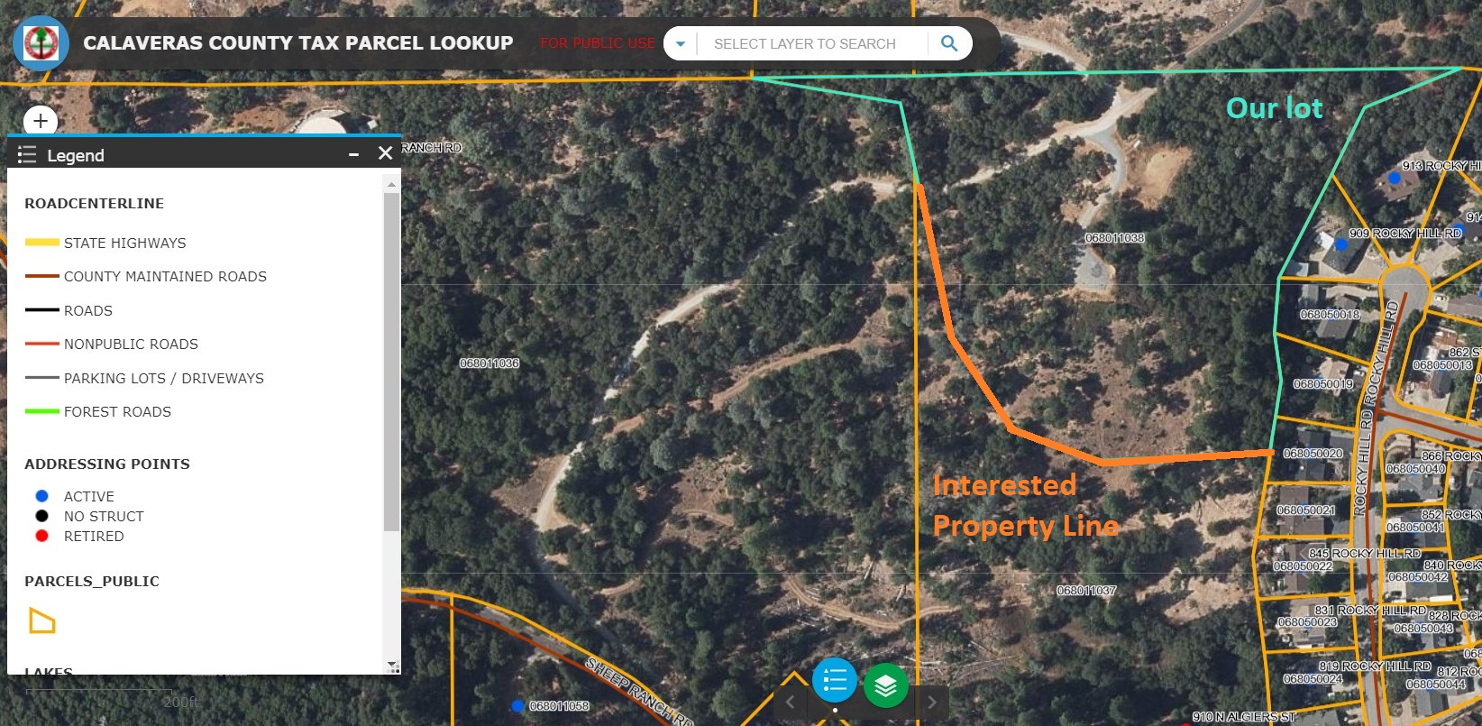
A formal survey was not part of the land purchasing process, and embarrassingly, we didn’t know where our property line boundaries physically fell. The southwestern line was particularly important for us if trying to connect to utility lines coming from the West.
Contacting a Local Surveyor
We found the number of a local surveyor and asked them to mark the corners of our property (I heard them refer to this as a “corner recovery”). While researching, we couldn’t find our southwest line in any county records or surveys.
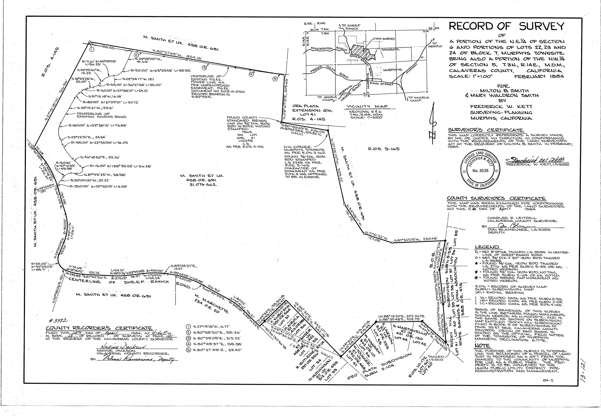
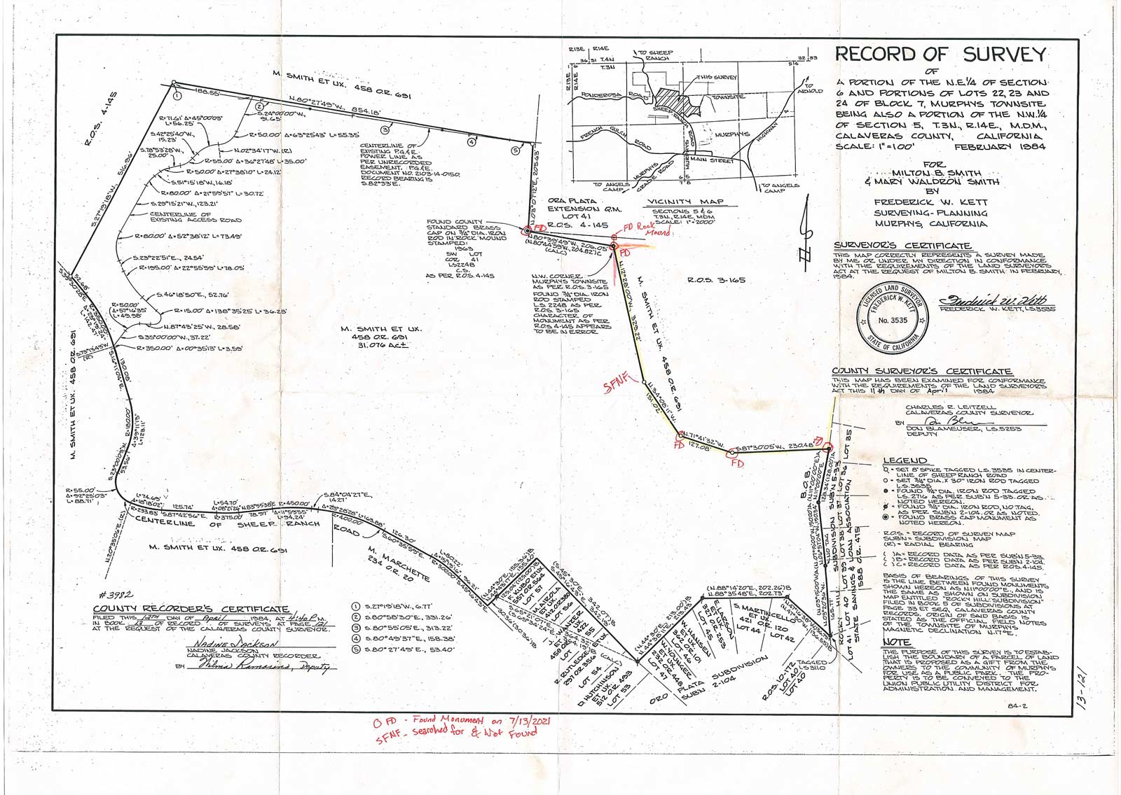
After calling the County Surveyor, we found a survey from 1984 that included the property line in question. Our property fell northeast of this plot, where R.O.S. 3-165 is printed on the map.
Surveying
The surveyors came out in September of 2021, and were able to mark all corners except for one (arguably the most important one for us, showing how far out east-west the property came). A large tree had fallen nearby and may have covered up the pin.

Discovery
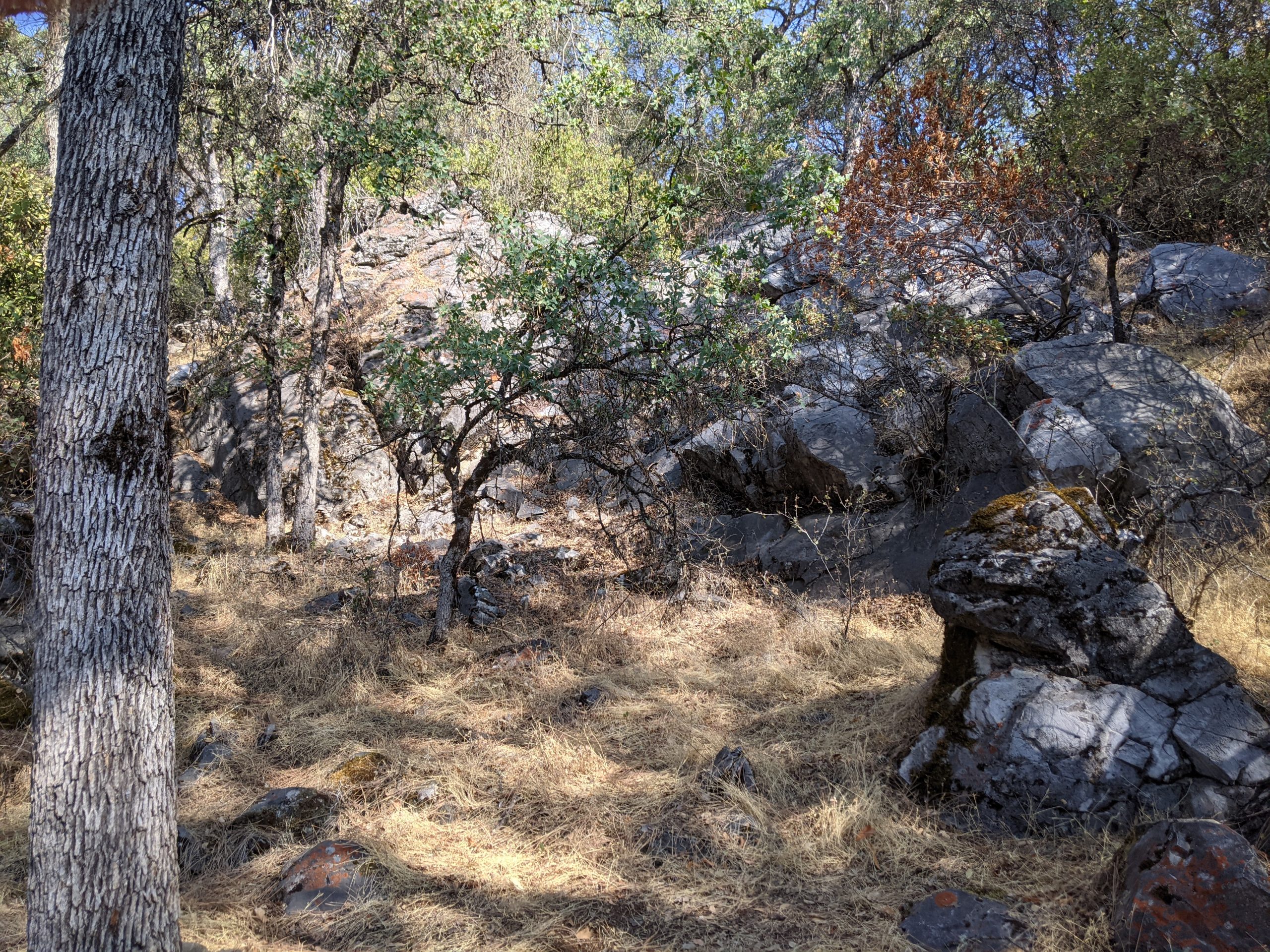
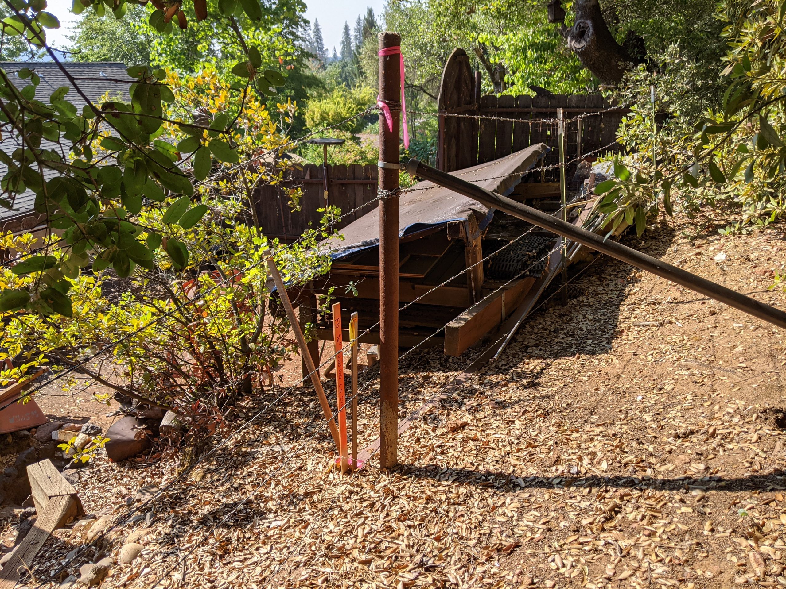
After owning the property for almost a year, we walked the actual marked property lines for the first time (as opposed to what we thought were the lines, and probably were trespassing a bit). We discovered a quiet and tranquil area in the northeast corner of the property with beautiful exposed rock.
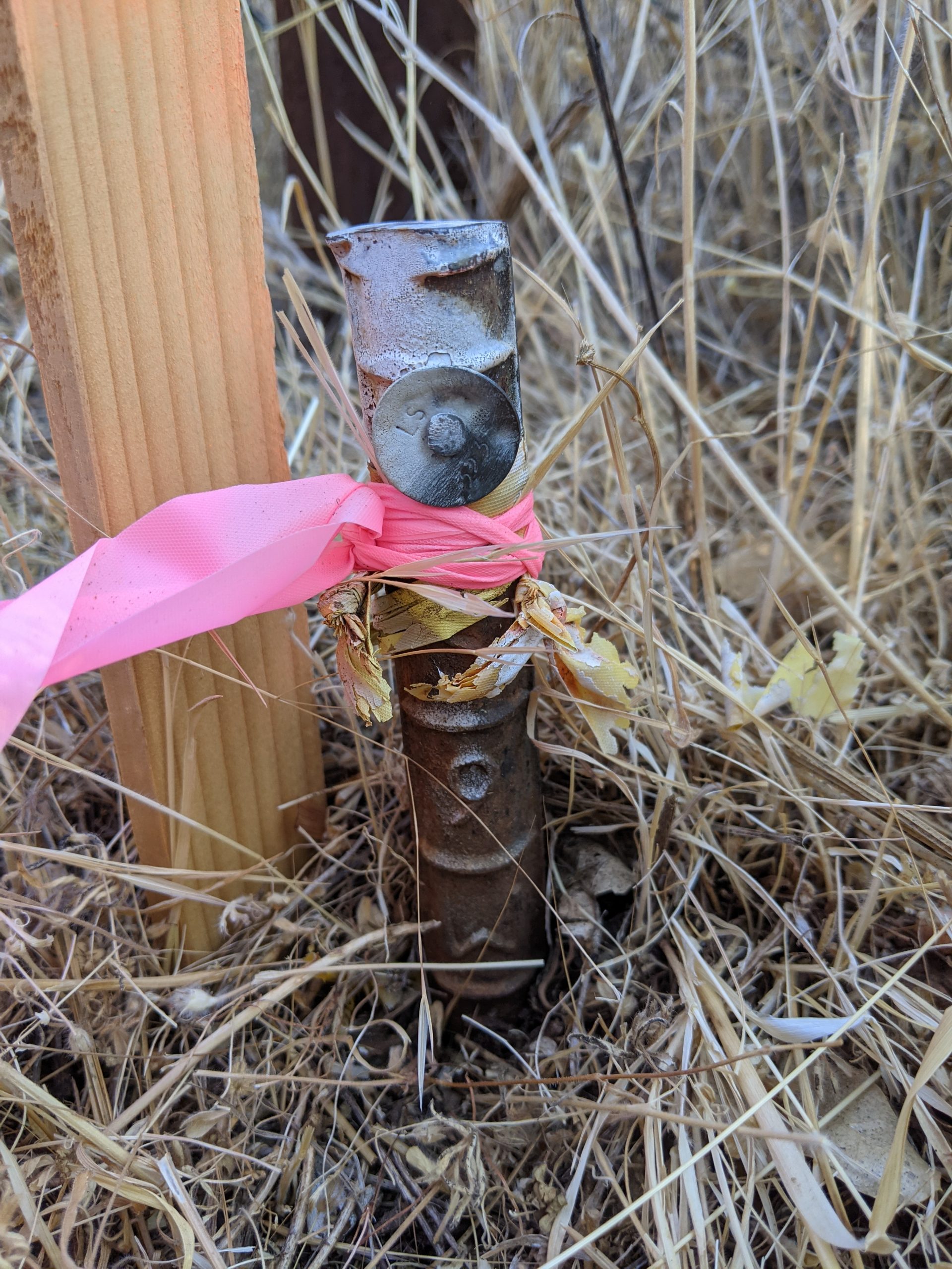
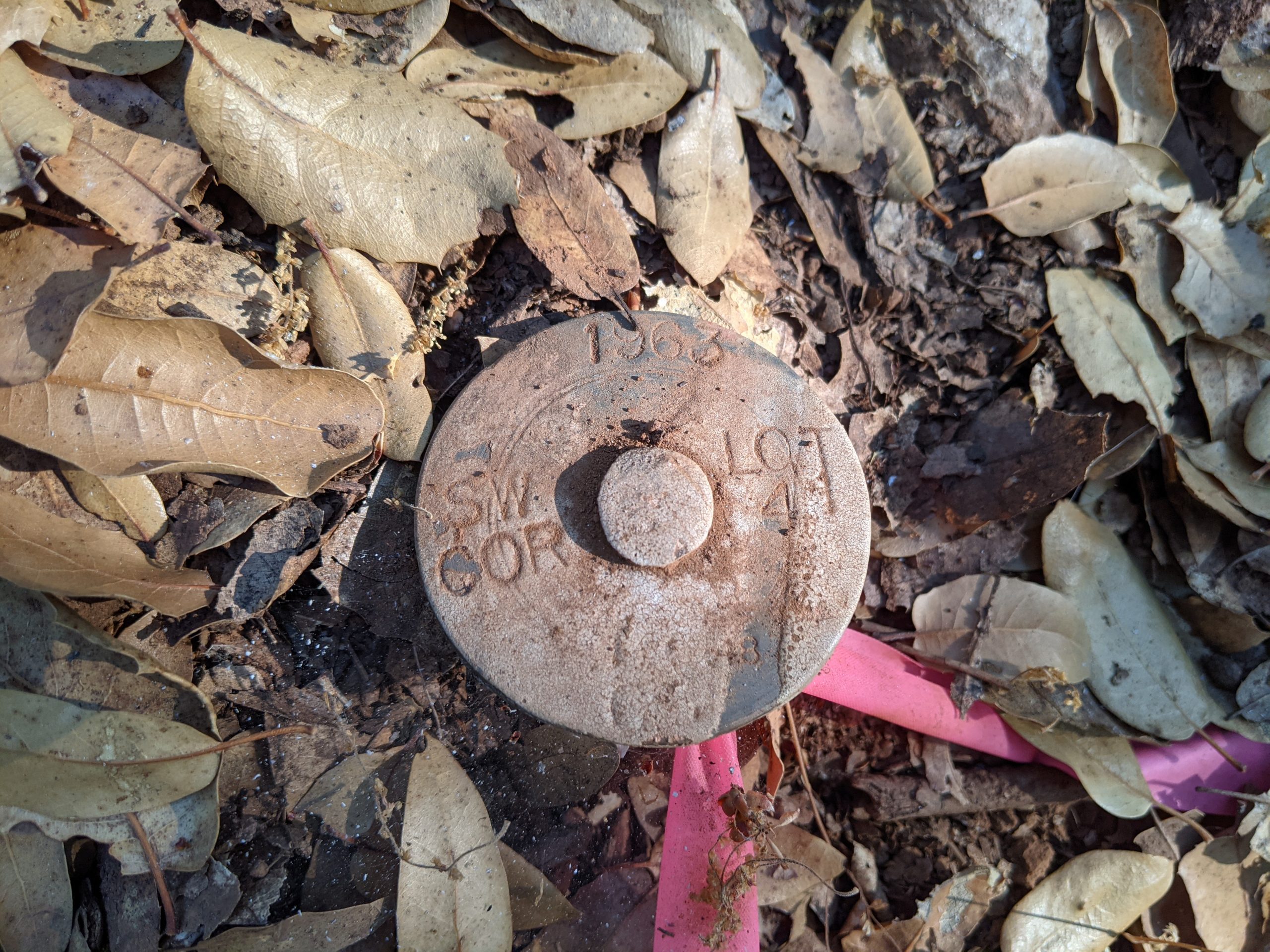
It was also interesting to look at how these lines were “officially” marked. Most featured a metal pin that kind of looked like a railroad tie. The northwestern most point of the property is marked with a larger cap. Definitely makes you think about the history of land ownership, and how messy sorting out all these boundaries must have been!
What’s Next
Now that the property lines are marked, we can focus on working with the utility companies to figure out how to get power and water out to the lot! Something tells me it will be more involved than this survey..
Comments
No responses yet